Showing posts with label Arnold. Show all posts

Monday, 18 July 2016

Meteora

In the 9th century AD, an ascetic group of hermit monks moved up to the ancient pinnacles; they were the first people to inhabit Metéora since the Neolithic Era. They lived in hollows and fissures in the rock towers, some as high as 1800 ft (550m) above the plain. This great height, combined with the sheerness of the cliff walls, kept away all but the most determined visitors. Initially, the hermits led a life of solitude, meeting only on Sundays and special days to worship and pray in a chapel built at the foot of a rock known as Dhoupiani.

The exact date of the establishment of the monasteries is unknown. By the late 11th and early 12th centuries, a rudimentary monastic state had formed called the Skete of Stagoi and was centered around the still-standing church of Theotokos (mother of God). By the end of the 12th century, an ascetic community had flocked to Metéora.

In 1344, Athanasios Koinovitis from Mount Athos brought a group of followers to Metéora. From 1356 to 1372, he founded the great Meteoron monastery on Broad Rock, which were perfect for the monks; they were safe from political upheaval and had complete control of the entry to the monastery. The only means of reaching it was by climbing a long ladder, which was drawn up whenever the monks felt threatened.

At the end of the 14th century, the Byzantine Empire's 800-year reign over northern Greece was being increasingly threatened by Turkish raiders who wanted control over the fertile plain of Thessaly. The hermit monks, seeking a retreat from the expanding Turkish occupation, found the inaccessible rock pillars of Meteora to be an ideal refuge. More than 20 monasteries were built, beginning in the 14th century. Six remain today.
Source: Wikipedia
Thanks to Arnold for the great card of Meterora!
Sent: 3 June 2016   Received: 23 June 2016  Travelled: 20 days

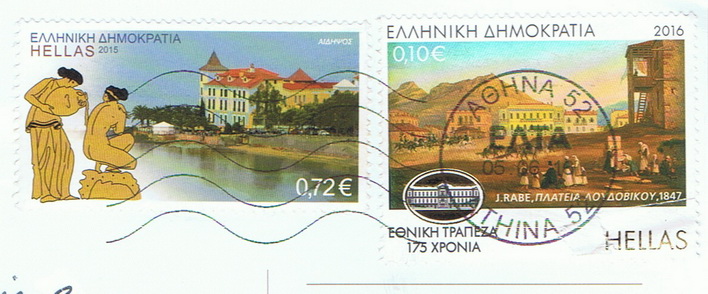
Acropolis


The Acropolis of Athens is an ancient citadel located on an extremely rocky outcrop above the city of Athens and contains the remains of several ancient buildings of great architectural and historic significance, the most famous being the Parthenon. The word acropolis comes from the Greek words ἄκρον (akron, "highest point, extremity") and πόλις (polis, "city"). Although there are many other acropoleis in Greece, the significance of the Acropolis of Athens is such that it is commonly known as "The Acropolis" without qualification.

While there is evidence that the hill was inhabited as far back as the fourth millennium BC, it was Pericles (c. 495 – 429 BC) in the fifth century BC who coordinated the construction of the site's most important buildings including the Parthenon, the Propylaia, the Erechtheion and the Temple of Athena Nike. The Parthenon and the other buildings were seriously damaged during the 1687 siege by the Venetians in the Morean War when the Parthenon was being used for gunpowder storage and was hit by a cannonball.
Source: Wikipedia

Thanks to Arnold who was in Greece recently for holidays!
Sent: 3 June 2016   Received: 23 June 2016   Travelled: 20 days

Tuesday, 14 June 2016

American Samoa

American Samoa  is an unincorporated territory of the United States located in the South Pacific Ocean, southeast of Samoa.
American Samoa consists of five main islands and two coral atolls. The largest and most populous island is Tutuila, with the Manuʻa Islands, Rose Atoll, and Swains Island also included in the territory. American Samoa is part of the Samoan Islands chain, located west of the Cook Islands, north of Tonga, and some 300 miles (500 km) south of Tokelau. To the west are the islands of the Wallis and Futuna group.
The 2010 census showed a total population of 55,519 people. The total land area is 199 square kilometers (76.8 sq mi), slightly more than Washington, D.C. American Samoa is the southernmost territory of the U.S. and one of two U.S. territories (with the uninhabited Jarvis Island) south of the Equator. Tuna products are the main exports, and the main trading partner is the United States.
Source: Wikipedia

Thank you Arnold for this special card from American Samoa!
Sent: 18 May 2016    Received: 1 June 2016   Travelled: 14 days

Friday, 3 June 2016

Tonga


Tonga , officially the Kingdom of Tonga, is a Polynesian sovereign state and archipelago comprising 169 islands of which 36 are inhabited. The total surface area is about 750 square kilometres scattered over 700,000 square kilometres (270,000 sq mi) of the southern Pacific Ocean. It has a population 103,000 people[5] of whom 70% reside on the main island of Tongatapu.
Tonga stretches over about 800 kilometres  in a north-south line – about a third of the distance from New Zealand to Hawaii. It is surrounded by Fiji and Wallis and Futuna (France) to the northwest, Samoa to the northeast, Niue to the east, Kermadec (part of New Zealand) to the southwest, and New Caledonia (France) and Vanuatu to the farther west.
Tonga became known as the Friendly Islands because of the congenial reception accorded to Captain James Cook on his first visit in 1773. He arrived at the time of the ʻinasi festival, the yearly donation of the First Fruits to the Tuʻi Tonga (the islands' paramount chief) and so received an invitation to the festivities. According to the writer William Mariner, the chiefs wanted to kill Cook during the gathering but could not agree on a plan.
Tonga became fully independent from Britain in May 1970, but had never relinquished its sovereignty to any foreign power. In 2010, Tonga took a decisive step towards becoming a fully functioning constitutional monarchy, after legislative reforms paved the way for its first partial representative elections.
Source: Wikipedia

Back again! Sorry for my absence, but I've been inundated with one 
cat emergency after another. Today's theme, if you notice, are all about islands! 
These are the last cards I have from the past two years which I never got to
blog and will now resume showing cards I've received currently.
Special thanks to Arnold for arranging this card from Tonga!
Sent: 7 August 2014   Received: 4 September 2014   Travelled: 28 days

Monday, 30 May 2016

Greenland

70th Birthday of HM the Queen Margrethe II dressed in
Greenlandic national costume.

Greenland  is an autonomous country within the Danish Realm, located between the Arctic and Atlantic Oceans, east of the Canadian Arctic Archipelago. Though physiographically a part of the continent of North America, Greenland has been politically and culturally associated with Europe (specifically Norway and Denmark, the colonial powers, as well as the nearby island of Iceland) for more than a millennium.In 2008, the people of Greenland passed a referendum supporting greater autonomy; 75% of votes cast were in favour. Greenland is the world's largest island, over three-quarters of which is covered by the only permanent ice sheet outside of Antarctica. With a population of about 56,480 (2013), it is the least densely populated country in the world.

Greenland has been inhabited off and on for at least the last 4,500 years by Arctic peoples whose forebears migrated there from what is now Canada. Norsemen settled the uninhabited southern part of Greenland beginning in the 10th century, and Inuit peoples arrived in the 13th century. The Norse colonies disappeared in the late 15th century. Soon after their demise, beginning in 1499, the Portuguese briefly explored and claimed the island, naming it Terra do Lavrador (later applied to Labrador in Canada). In the early 18th century, Scandinavia and Greenland came back into contact with each other, and Denmark-Norway affirmed sovereignty over the island.

Denmark–Norway claimed Greenland for centuries. Greenland was settled by Norwegians over a thousand years ago, who had previously settled Iceland to escape persecution from the King of Norway and his central government. It was from Greenland and Iceland that Norwegians would set sail to discover America for Europeans almost 500 years before Columbus and attempt to colonize land. Though under continuous influence of Norway and Norwegians, Greenland was not formally under the Norwegian crown until 1262. The Kingdom of Norway was extensive and a military power until the mid-14th century. Norway was dramatically hit with a larger death toll than Denmark by the Black Death, forcing Norway to accept a union in which the central government, university and other fundamental institutions were located in Copenhagen. Thus, the two kingdoms' resources were directed at creating Copenhagen, resulting in Norway becoming the weaker part and losing sovereignty over Greenland in 1814 in the dissolution of the union. Greenland thus became a Danish colony in 1814, and a part of the Danish Realm in 1953 under the Constitution of Denmark.
Source:Wikipedia

Thanks to Arnold for this Royalty card and my first written and stamped
Greenlandic card! :)
Sent: 19 August 2014   Received: 5 Sept 2014   Travelled: 17 days

Thursday, 14 April 2016

West Virginia

Thanks to Arnold for a nother great map card for my collection!
Sent: 25 March 2016   Received: 12 April 2016   Travelled: 18 days

Wednesday, 30 March 2016

Easter Islanders


HAHAHAHAHA
I love this card of the Moai statues and the imagined underground
bodies, possibly petrified giants who were buried a milenia ago?
thanks so much to Arnold for this postcard and great stamps!
Sent: 7 March 2016   Received: 22 March 2016   Travelled: 15 days

Monday, 21 March 2016

Bobcat

The bobcat (Lynx rufus) is a North American cat that appeared during the Irvingtonian stage of around 1.8 million years ago (AEO).[4] Containing 12 recognized subspecies, it ranges from southern Canada to central Mexico, including most of the continental United States. The bobcat is an adaptable predator that inhabits wooded areas, as well as semidesert, urban edge, forest edges, and swampland environments. It remains in some of its original range, but local populations are vulnerable to extirpation by coyotes and domestic animals. The bobcat is vital for controlling pest populations. With a gray to brown coat, whiskered face, and black-tufted ears, the bobcat resembles the other species of the mid-sized Lynx genus. It is smaller on average than the Canada lynx, with which it shares parts of its range, but is about twice as large as the domestic cat. It has distinctive black bars on its forelegs and a black-tipped, stubby tail, from which it derives its name.
Source: Wikipedia

Thanks to Arnold for this swap!
Sent: 11 February 2016    Received: 29 February 2016   Travelled: 18 days

Thursday, 10 March 2016

Altun Ha, Belize


Altun Ha  is the name given to the ruins of an ancient Mayan city in Belize, located in the Belize District about 50 km north of Belize City and about 10 km west of the shore of the Caribbean Sea. The site covers an area of about 8 km square. Stones from the ruins of the ancient structures were reused for residential construction of the agricultural village of Rockstone Pond in modern times, but the ancient site did not come to the attention of archeologists until 1963. The Old Northern Highway connects Altun Ha to Belize's Northern Highway, and the site is accessible for tourism. The largest of Altun Ha's temple-pyramids, the "Temple of the Masonry Altars", is 16 m high. A drawing of this structure is the logo of Belize's leading brand of beer, "Belikin".
Source:Wikipedia

Thank you Arnold for this nice postcard from  your visit to Belize!
Sent: 24 November 2015   Received: 17 December 2015   Travelled: 23 days

Thursday, 29 October 2015

Cheetahs from South Africa

The word "cheetah" is derived from Hindi , in turn from Sanskrit citrakāyaḥ, meaning "variegated".
The cheetah (Acinonyx jubatus) is a big cat in the subfamily Felinae that inhabits most of Africa and parts of Iran. It is the only extant member of the genus Acinonyx. The cheetah can run as fast as 109.4 to 120.7 km/h (68.0 to 75.0 mph), faster than any other land animal.It covers distances up to 500 m (1,640 ft) in short bursts, and can accelerate from 0 to 96 km/h (0 to 60 mph) in three seconds.
The cheetah is a unique felid, with its closest living relatives being the puma and jaguarundi of the Americas. This cat is notable for modifications in the species' paws, being one of the few felids with only semi-retractable claws.
Its main hunting strategy is to trip swift prey such as various antelope species and hares with its dewclaw. Almost every facet of the cheetah's anatomy has evolved to maximise its success in the chase, the result of an evolutionary arms race with its prey. Due to this specialisation, however, the cheetah is poorly equipped to defend itself against other large predators, with speed being its main means of defence.
In the wild, the cheetah is a prolific breeder, with up to nine cubs in a litter. The majority of cubs do not survive to adulthood, mainly as a result of depredation from other predators. The rate of cub mortality varies from area to area, from 50% to 75%, and in extreme cases such as the Serengeti ecosystem, up to 90%. Cheetahs are notoriously poor breeders in captivity, though several organizations, such as the De Wildt Cheetah and Wildlife Centre, have succeeded in breeding high numbers of cubs.
Source:Wikipedia
Big thanks to Arnold for this amazing wildlife card of Cheetahs
and the fantastic matching stamps. So delighted to receive this :D
This card is especially cool because the pair of cats here twisted like a
sleek "S" and there's a heart in the middle :)
Sent: 12 Oct    Received: 27 October 2015   Travelled: 15 days

Thursday, 7 May 2015

Stegosaurus


Stegosaurus( meaning "roof lizard" or "covered lizard" in reference to its bony plates) is a genus of armoured stegosaurid dinosaur. They lived during the Late Jurassic period (Kimmeridgian to early Tithonian), some 155 to 150 million years ago in what is now western North America. In 2006, a specimen of Stegosaurus was announced from Portugal, showing that they were present in Europe, as well.Due to its distinctive tail spikes and plates, Stegosaurus is one of the most recognizable dinosaurs. At least three species have been identified in the upper Morrison Formation and are known from the remains of about 80 individuals.
Thanks to Arnold for this awesome Dinosaur postcard for my collection.
CAN'T WAIT FOR JURASSIC WORLD TO COME TO THE SCREEN! 
Yes I have a thing for dinosaurs.....among other stuff >.>
Sent: 24 April 2015   Received: 6 May 2015   Travelled: 12 days


Tuesday, 24 March 2015

St Augustine

San Agustín was founded in September of 1565 by Spanish admiral and Florida's first governor, Pedro Menéndez de Avilés. It served as the capital of Spanish Florida for over 200 years. St. Augustine remained the capital of East Florida when the territory briefly changed hands between Spain and Britain, and it remained the capital of the Florida Territory until it was moved to Tallahassee in 1824. Since the late 19th century, its distinct historical character has made the city a major tourist attraction. It is also the headquarters for the Florida National Guard.

Thanks to Arnold for this funny card of Pirates!
Sent: 25 February 2015   Received: 18 March 2015   Travelled: 21 days

Friday, 27 February 2015

Illinois map

Illinois is a state in the Midwestern United States. It is the 5th most populous state and 25th largest state in terms of land area, and is often noted as a microcosm of the entire country.With Chicago in the northeast, small industrial cities and great agricultural productivity in central and northern Illinois, and natural resources like coal, timber, and petroleum in the south, Illinois has a diverse economic base and is a major transportation hub.
Thanks to Arnold for this great map card!

Friday, 20 February 2015

Connecticut map


Connecticut: Constitution State/Provision State/ Nutmeg State
Capital: Hartford  Land area: 4,872 sq. mi.
Motto: Qui transtulit sustained ( He who transplanted still sustains)
Flower: Mountain laurel     Bird: Robin     Tree: White Oak
Statehood: 9 January 1788. Fift of the original 13 states.

Thanks to Arnold for this map postcard for my USA states map collection!
Sent: 10 November 2014   Received: 24 November 2014   Travelled: 14 days

Friday, 2 January 2015

Nevada map card

Nevada is the 7th most extensive, the 35th most populous, and the 9th least densely populated of the 50 United States. Nearly three-quarters of Nevada's people live in Clark County, which contains the Las Vegas–Paradise metropolitan area[5] where the state's three largest incorporated cities are located.[6] Nevada's capital is Carson City. Nevada is officially known as the "Silver State" due to the importance of silver to its history and economy. It is also known as the "Battle Born State", because it achieved statehood during the Civil War; "Sagebrush State", for the native plant of the same name; and "Sage hen State."
Thanks to Arnold for this missing US State map card and the amazing 
Circus stamps!
Sent: 24 August 2014   Received: 5 September 2014   Travelled: 12 days

Monday, 27 January 2014

Exaggeration!


Thank you Arnold for this funny card from the US!

Sent: 13 January 2014
Received: 27 January 2014
travelled: 14 days